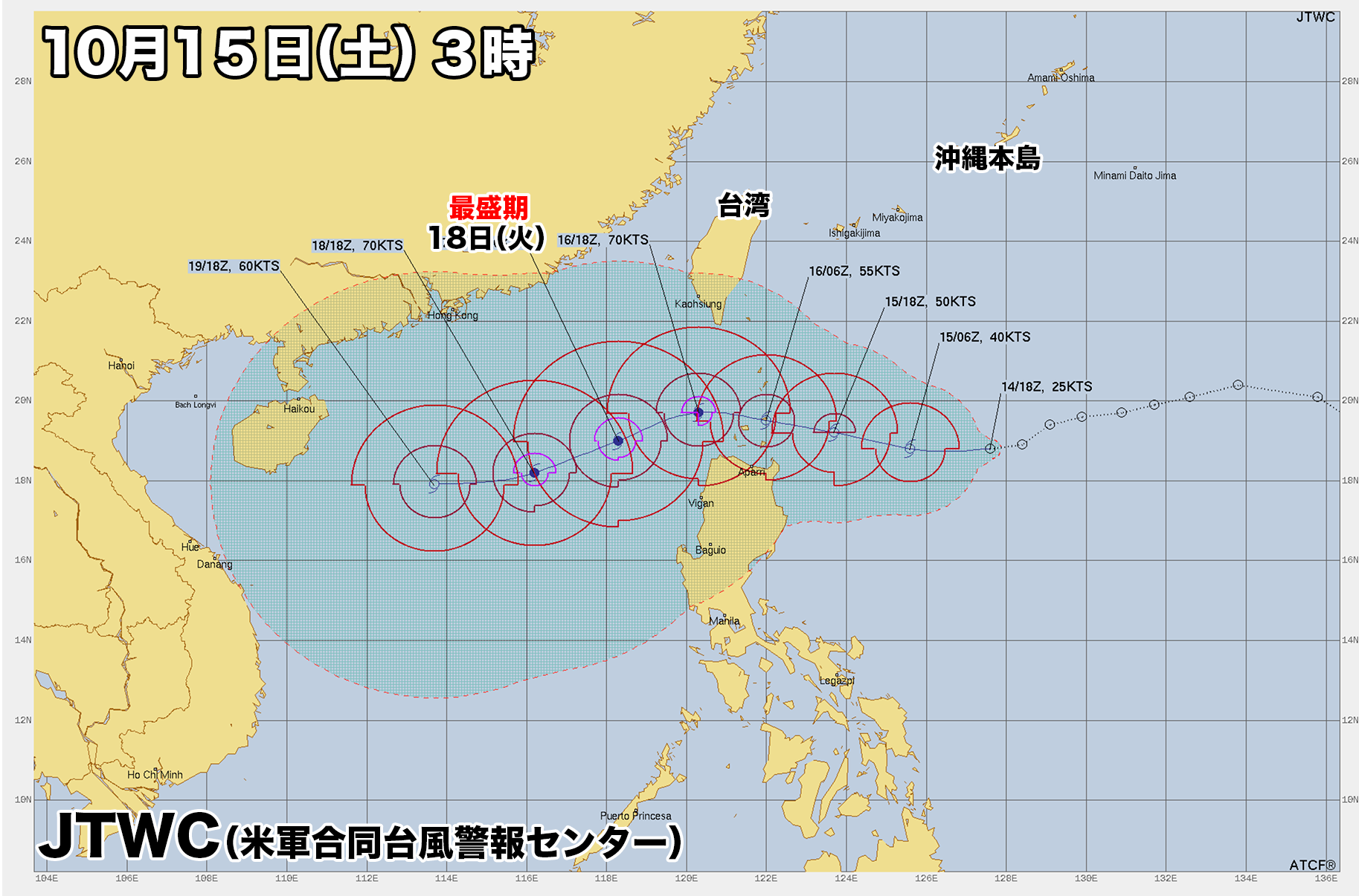

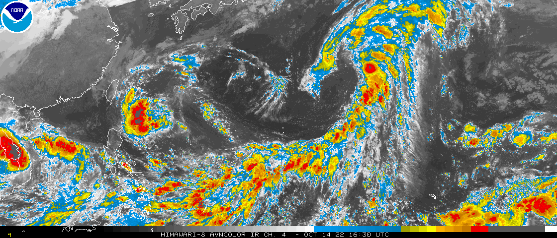
沖縄の南にある熱帯低気圧があすまでに台風に発達する可能性が出てきた。
気象庁によると午前3時現在、熱帯低気圧の中心はフィリピンの東にあり、時速約15キロで西に進んでいる。中心付近の最大風速は15メートル。中心気圧は998ヘクトパスカル。
熱帯低気圧はこのあとやや発達しながら西に進みあすまでに台風に発達、あさってにかけて台湾とフィリピンの間のバシー海峡を進む見込み。最盛期となるのは18日火曜日。南シナ海で最大瞬間風速は35メートルに達する。
この影響で、沖縄の先島諸島では月曜日から火曜日にかけて大雨になる恐れがある。
There is a possibility that a tropical cyclone south of Okinawa will develop into a typhoon by tomorrow.
As of 3 p.m., the center of the tropical cyclone was east of the Philippines and was moving west at about 15km/h, according to the Japan Meteorological Agency.
The maximum wind speed near the center is 15 m/s. The central atmospheric pressure is 998hPa.
The tropical cyclone is expected to develop slightly and move westward, become a typhoon by tomorrow, moving through the Bashi Channel between Taiwan and the Philippines the day after tomorrow. The peak is on Tuesday. The maximum instantaneous wind speed reaches 35m/s in the South China Sea.
As a result, Okinawa’s Sakishima Islands could experience heavy rain Monday through Tuesday.

コメント