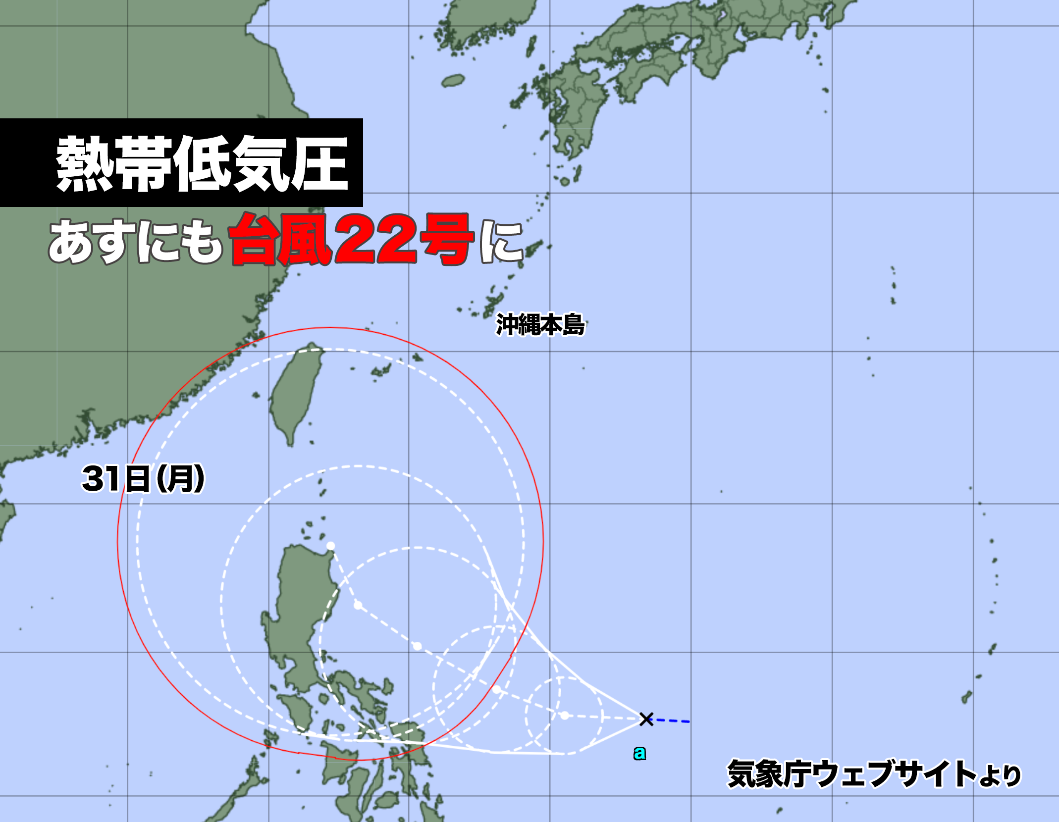

フィリピンの東にある熱帯低気圧があすまでに台風22号になる可能性がある。
26日午後6時現在、中心気圧は1002ヘクトパスカル、1時間に20キロの速さで西に進んでいる。
海水温が高いエリアを進むため発達を続け、日曜日から月曜日にかけては暴風域を伴いフィリピンのルソン島にかなり接近する見込みだ。
アメリカ海洋大気庁の予想では、来週前半は北上して沖縄に接近する可能性も出ている。南西諸島は荒れ模様になる恐れがあるので、最新の情報に注意したい。
A tropical depression east of the Philippines may become Typhoon No. 22 by tomorrow.
As of 6:00 pm on the 26th, the central pressure was 1002 hPa, and it was moving westward at a speed of 20 km/h.
It will continue to develop as it moves through areas of warm sea water, and is expected to approach Luzon Island in the Philippines from Sunday to Monday with strong winds.
According to forecasts by the National Oceanic and Atmospheric Administration, there is a possibility that it will move northward and approach Okinawa in the first half of next week. The Nansei Islands are likely to be inclement weather, so please pay attention to the latest information.

コメント