・24時間以内に南シナ海で台風4号が発生
・18日火曜日にトンキン湾を通過
・19日水曜日にベトナムで熱帯低気圧に
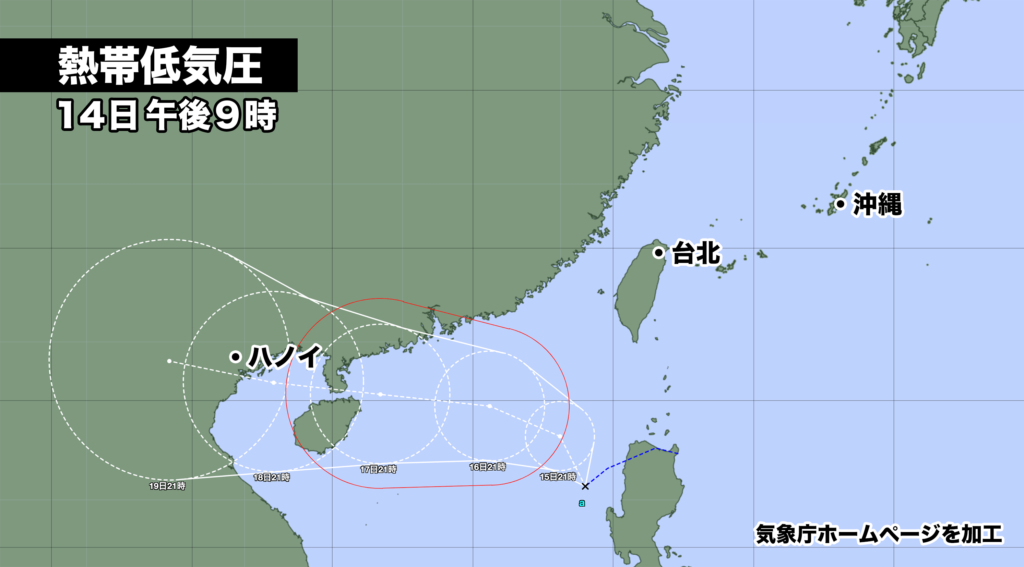
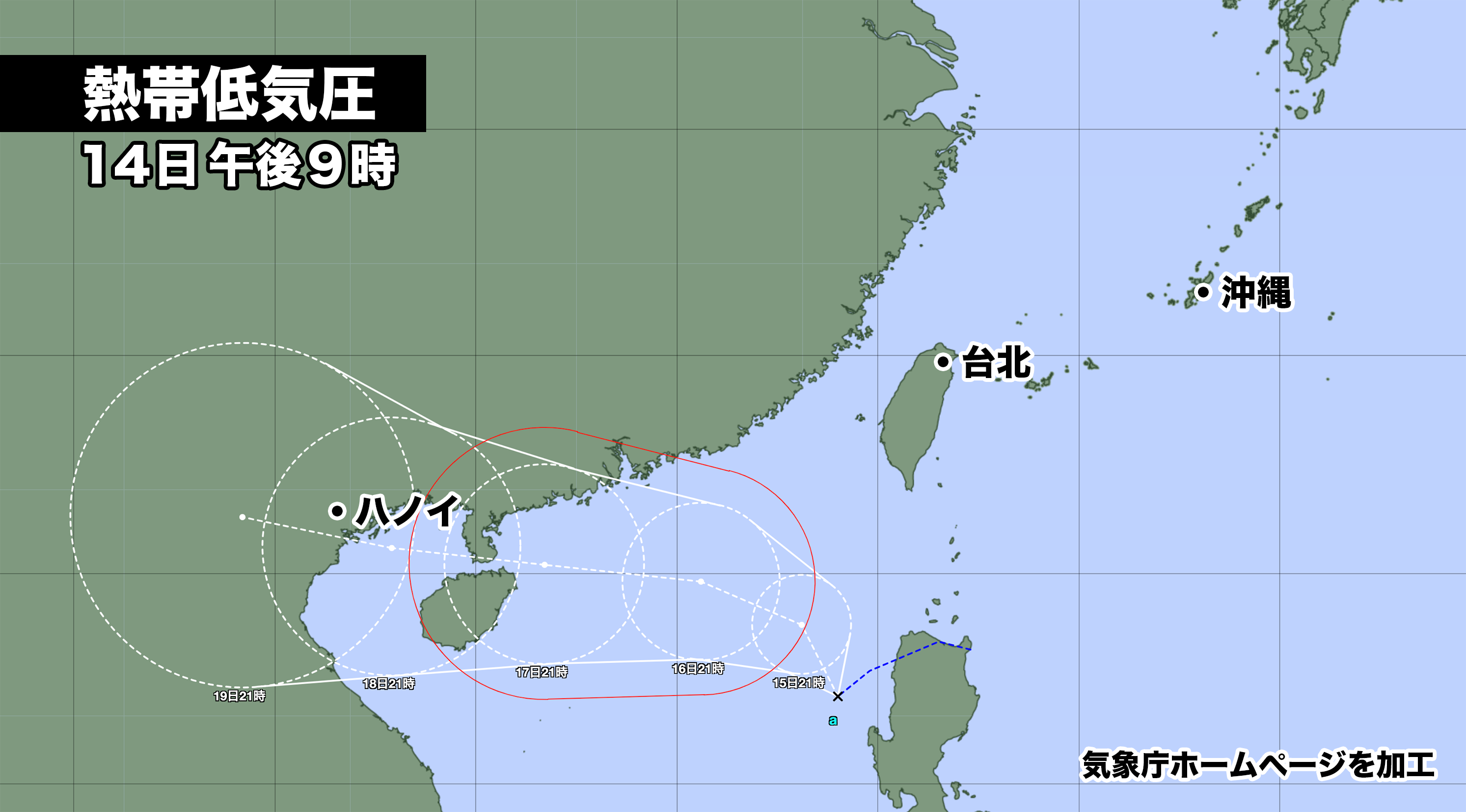
南シナ海にある熱帯低気圧が24時間以内に台風4号になる見込み。
14日午後9時現在、中心気圧は998ヘクトパスカル、中心付近の最大風速は15メートル(30ノット)、最大瞬間風速は23メートル(45ノット)。時速20キロ(10ノット)で南西に進んでいる。

台風が予報円の中心を進むと、18日火曜日にトンキン湾を通過し、18日夜遅くから19日水曜日かけてベトナムに上陸。その後、熱帯低気圧に変わる。

※熱帯低気圧とは(気象庁ウェブサイトより)
・熱帯または亜熱帯地方に発生する低気圧の総称で、風の弱いものから台風やハリケーンのように強いものまである。
・気象情報等で「熱帯低気圧」を用いる場合は、台風に満たない、低気圧域内の最大風速がおよそ17m/s(34ノット、風力8)未満のものを指す。
A tropical depression located in the South China Sea is expected to become Typhoon 4 within the next 24 hours. As of 9:00 PM on the 14th, the central pressure is 998 hPa, with maximum sustained winds near the center at 15 meters per second (30 kt) and maximum gusts at 23 meters per second (45 kt). It is moving southwestward at a speed of 20 kilometers per hour (10 kt).
If the typhoon follows the forecasted track, it will pass through the Gulf of Tonkin on Tuesday the 18th and make landfall in Vietnam from late evening on the 18th through Wednesday the 19th. Afterward, it will transition into a tropical depression.

コメント