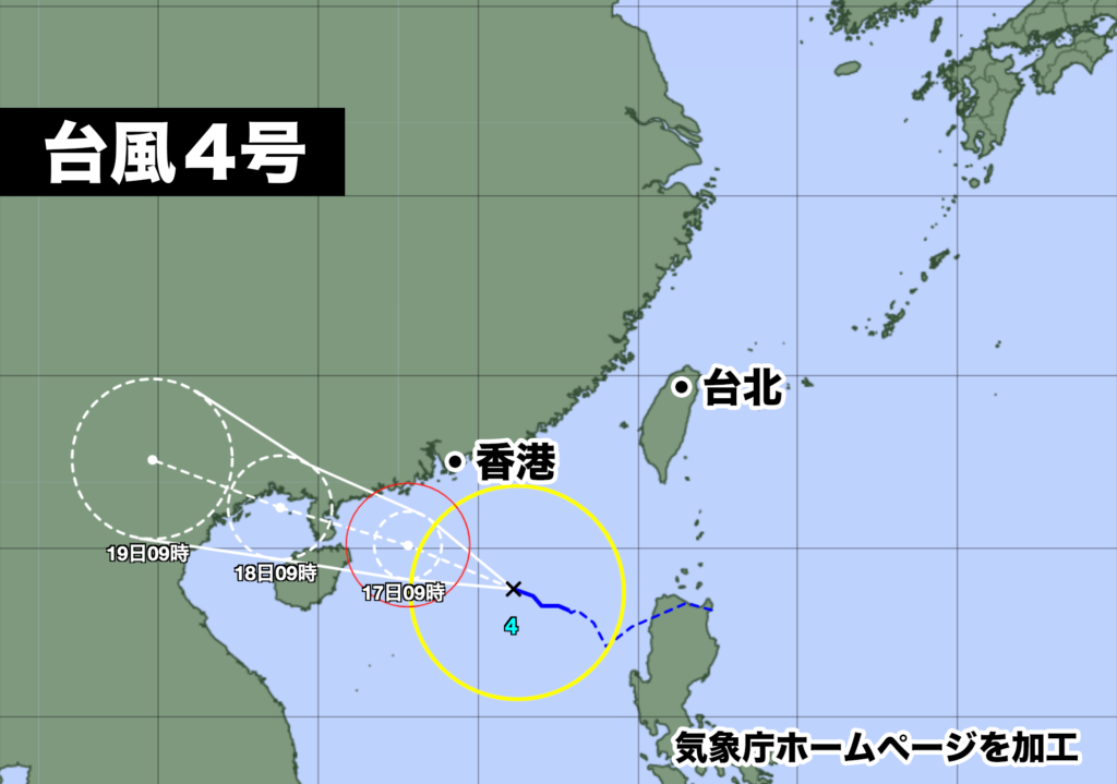
きのう土曜日に南シナ海で発生した台風4号は、やや発達しながら西寄りに進んでいる。
午前9時現在、中心気圧は980hPa、中心付近の最大風速は25m/s、最大瞬間風速は35m/s。時速10km/hの比較的ゆっくりしたスピードで西北西に進んでいる。
台風はこのあとも西に進む予想で、予報円の中心を進んだ場合、18日火曜日にトンキン湾、19日水曜日にベトナムに進み、熱帯低気圧に変わる見込み。

日本への直接の影響はないが、ベトナムでは18日火曜日から19日水曜日にかけて、大雨、暴風、高波に警戒が必要だ。
Typhoon No. 4, which formed in the South China Sea yesterday, is moving slightly westward while gradually intensifying.
As of 9:00 AM, the central pressure is 980 hPa, the maximum sustained wind speed near the center is 25 m/s, and the maximum gust speed is 35 m/s. It is moving at a relatively slow speed of 10 km/h towards the west-northwest.
The typhoon is expected to continue moving westward, and if it follows the center of the forecasted track, it is projected to reach the Gulf of Tonkin on Tuesday the 18th and Vietnam on Wednesday the 19th, eventually transitioning into a tropical depression.
There will be no direct impact on Japan; however, in Vietnam, caution is necessary for heavy rain, strong winds, and high waves from Tuesday the 18th to Wednesday the 19th.


コメント