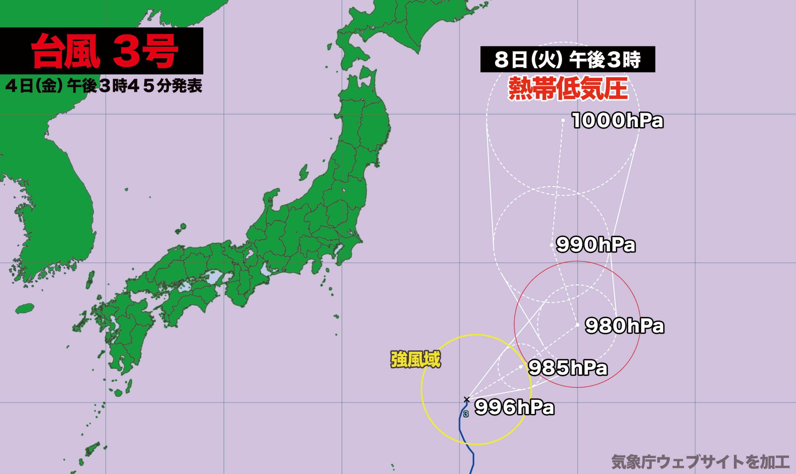

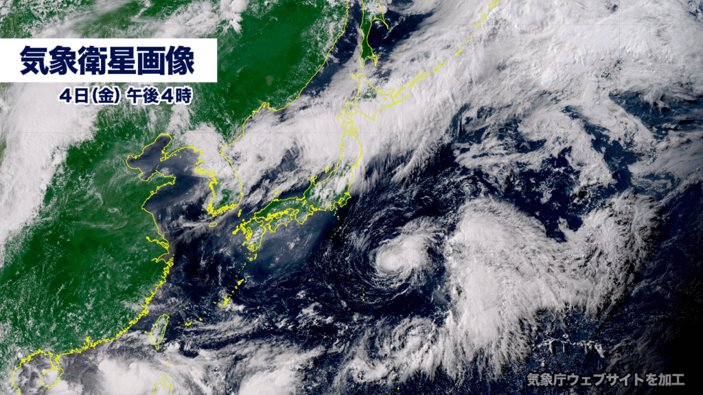
7月4日午後3時現在、台風3号は日本の東海上を北北東に進んでいます。
中心気圧は996ヘクトパスカル、中心付近の最大風速は20メートルで風速15メートル以上の強風域を伴っています。
台風はこのあとやや発達しながら東よりに進み、その後、北上します。現時点で日本に接近または上陸する可能性は低く、8日火曜日に日本の東海上で熱帯低気圧に変わる見込みです。
As of 3:00 p.m. on July 4, Typhoon No. 3 is moving north-northeast over the waters east of Japan.
The central pressure is 996 hPa, with maximum sustained winds near the center reaching 20 meters per second. The storm is accompanied by an area of strong winds exceeding 15 meters per second.
The typhoon is expected to move eastward while gradually strengthening, then turn northward. At this time, the likelihood of it approaching or making landfall in Japan is low. It is forecast to weaken into a tropical depression over the waters east of Japan by Tuesday, July 8.
コメント