
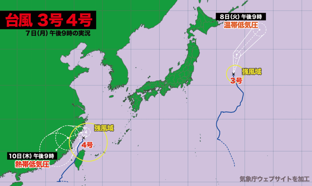
7日(月)午後9時の台風情報
台風3号は日本の東海上を時速20キロで北北西に進んでいる。中心気圧は998ヘクトパスカル。あす火曜日には北海道の東で温帯低気圧に変わる見込み。
台湾を通過した台風4号は現在、東シナ海を北上中。中心気圧は990ヘクトパスカル。あす火曜日の午後に西寄りに進路を変え、中国大陸に上陸。10日(木)に熱帯低気圧に変わる。

Typhoon Update as of 9:00 PM, Monday, July 7
Typhoon No. 3 is currently moving north-northwest over the Pacific Ocean east of Japan at a speed of 20 kilometers per hour. Its central pressure is 998 hPa. The system is expected to transition into an extratropical cyclone east of Hokkaido on Tuesday.
Meanwhile, Typhoon No. 4, which passed over Taiwan, is now tracking northward over the East China Sea. It has a central pressure of 990 hPa. The typhoon is forecast to shift westward and make landfall on the Chinese mainland Tuesday afternoon, then weaken into a tropical depression by Thursday, July 10.

コメント