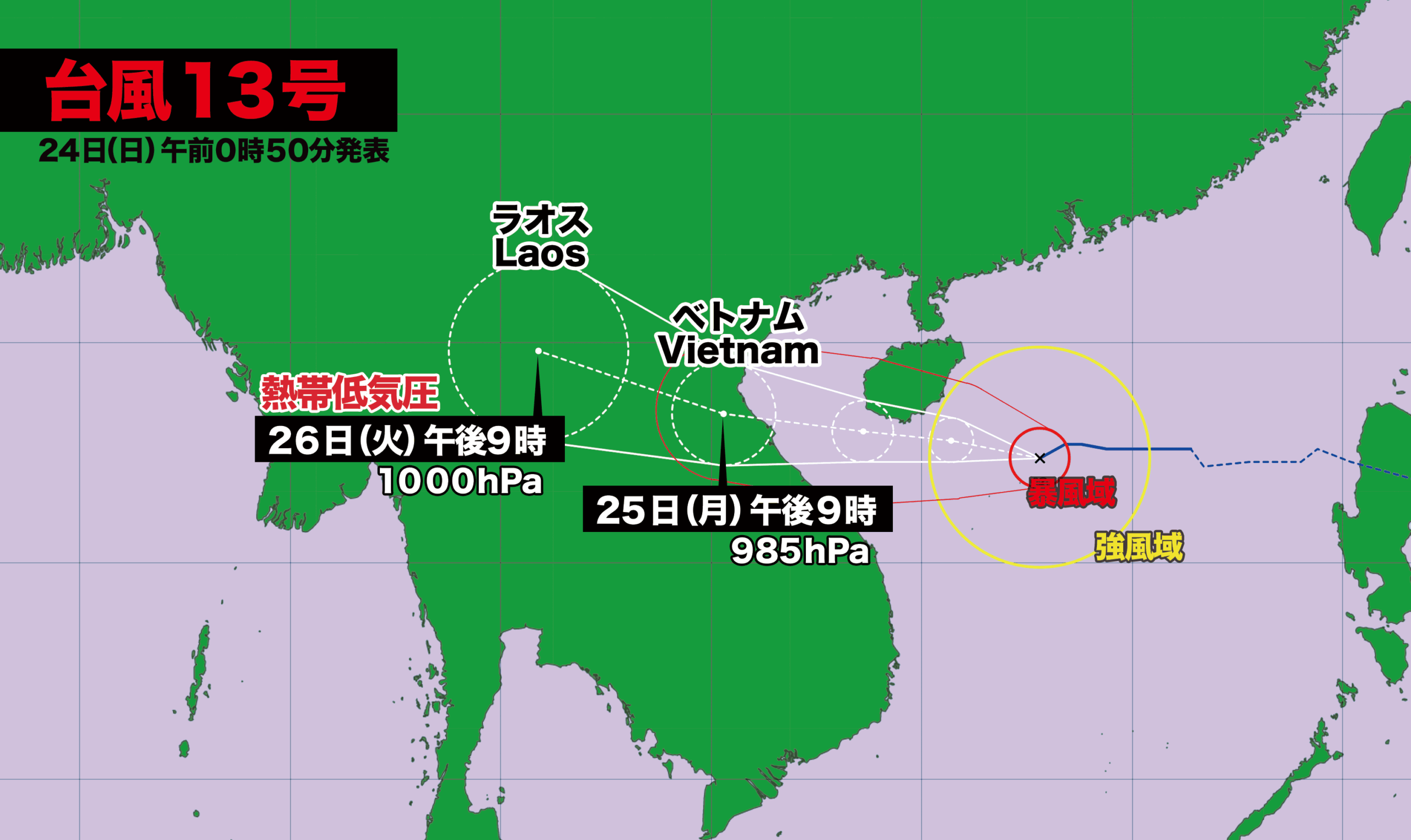
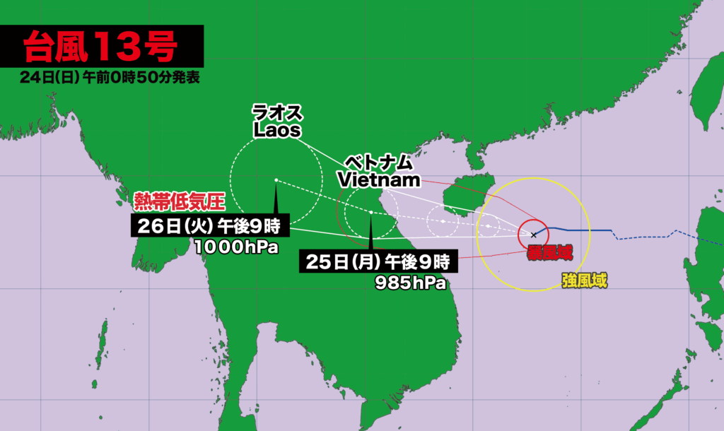
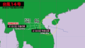
【24日(日)午前0時】
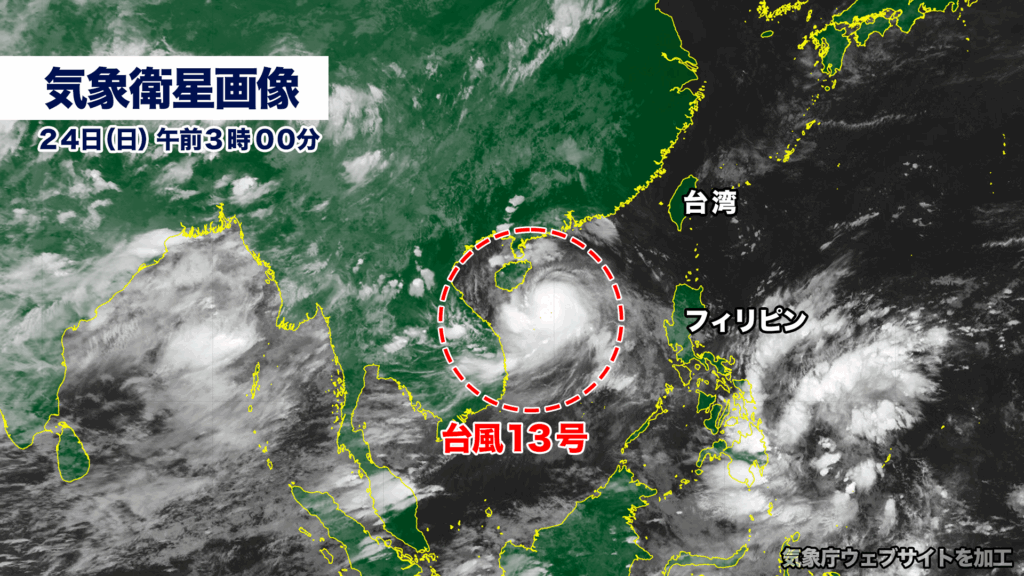
台風13号は現在、南シナ海を時速20キロで西に進んでいる。中心気圧は980ヘクトパスカル、中心付近の最大風速は30メートル、最大瞬間風速は40メートル。風速25メートル以上の風が吹く暴風域を伴っている。
台風はこのあと勢力を強めながら西に進み、24日(日)午後にハイナン島の南を通過、25日(月)はベトナムに上陸し、26日(火)にラオスで熱帯低気圧に変わる見込み。
ベトナム上陸時は、中心気圧が985ヘクトパスカル、最大瞬間風速が40メートルと予想されており、大きな被害が出る恐れがある。
[Sunday, 24th — 12:00 a.m.]
Typhoon Kajiki(Typhoon No. 13) is currently moving westward across the South China Sea at a speed of 20 kilometers per hour. The storm has a central pressure of 980 hectopascals, with maximum sustained winds near the center of 30 meters per second and gusts reaching 40 meters per second. It is accompanied by a storm-force wind field with sustained winds exceeding 25 meters per second.
The typhoon is forecast to continue westward while strengthening, passing south of Hainan Island on Sunday afternoon. It is expected to make landfall in Vietnam on Monday the 25th, before weakening into a tropical depression over Laos on Tuesday the 26th.
Upon making landfall in Vietnam, the storm is projected to have a central pressure of 985 hectopascals with maximum gusts of around 40 meters per second, raising concerns of significant damage.
コメント