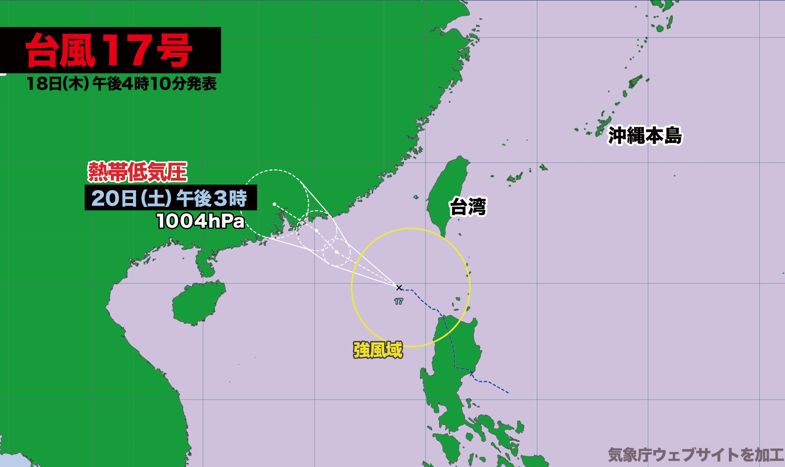

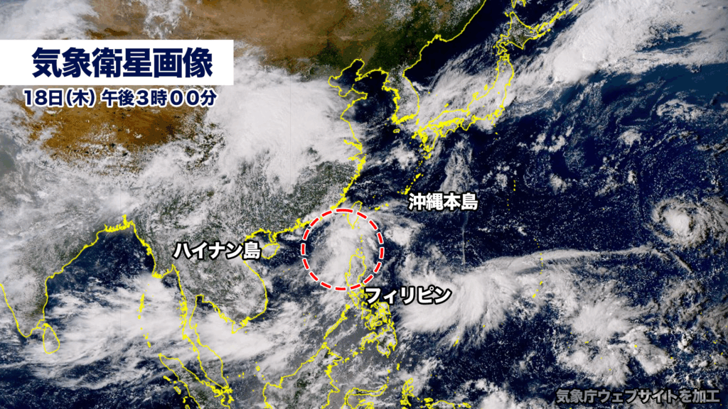
【18日木曜日午後4時】
18日午後3時に南シナ海にあった熱帯低気圧が台風17号(ミートク)に発達しました。
現在、風速15メートル以上の強風域を伴い、南シナ海を時速約20キロで西に進んでいます。中心気圧は1002ヘクトパスカル。
台風はこの後、西寄りに進む見込みで、19日金曜日の深夜に中国大陸に上陸し、20日土曜日に熱帯低気圧に変わる見込みです。
[Thursday, 18th – 4:00 p.m.]
At 3:00 p.m. on the 18th, a tropical depression over the South China Sea strengthened into Typhoon No. 17, named Mitag.
The storm is currently moving westward across the South China Sea at about 20 kilometers per hour, accompanied by an area of strong winds exceeding 15 meters per second. Its central pressure is estimated at 1002 hectopascals.
Forecasts indicate that the typhoon will continue on a westward track, making landfall on the Chinese mainland late Friday night, the 19th, and is expected to weaken into a tropical depression by Saturday, the 20th.
| 台風第17号(ミートク) | |
|---|---|
| 2025年09月18日16時10分発表 | |
| 18日15時の実況 | |
| 種別 | 台風 |
| 大きさ | – |
| 強さ | – |
| 存在地域 | 南シナ海 |
| 中心位置 | 北緯19度50分 (19.8度) 東経118度50分 (118.8度) |
| 進行方向、速さ | 西北西 20 km/h (10 kt) |
| 中心気圧 | 1002 hPa |
| 中心付近の最大風速 | 18 m/s (35 kt) |
| 最大瞬間風速 | 25 m/s (50 kt) |
| 15m/s以上の強風域 | 東側 330 km (180 NM) |
| 西側 220 km (120 NM) | |
| 19日03時の予報 | |
| 種別 | 台風 |
| 強さ | – |
| 存在地域 | 南シナ海 |
| 予報円の中心 | 北緯21度20分 (21.3度) 東経116度00分 (116.0度) |
| 進行方向、速さ | 西北西 30 km/h (15 kt) |
| 中心気圧 | 1002 hPa |
| 中心付近の最大風速 | 18 m/s (35 kt) |
| 最大瞬間風速 | 25 m/s (50 kt) |
| 予報円の半径 | 65 km (35 NM) |
| 19日15時の予報 | |
| 種別 | 台風 |
| 強さ | – |
| 存在地域 | 南シナ海 |
| 予報円の中心 | 北緯22度10分 (22.2度) 東経115度05分 (115.1度) |
| 進行方向、速さ | 北西 10 km/h (6 kt) |
| 中心気圧 | 1000 hPa |
| 中心付近の最大風速 | 20 m/s (40 kt) |
| 最大瞬間風速 | 30 m/s (60 kt) |
| 予報円の半径 | 95 km (50 NM) |
| 20日15時の予報 | |
| 種別 | 熱帯低気圧 |
| 強さ | – |
| 存在地域 | 華南 |
| 予報円の中心 | 北緯23度20分 (23.3度) 東経113度10分 (113.2度) |
| 進行方向、速さ | 西北西 ゆっくり |
| 中心気圧 | 1004 hPa |
| 予報円の半径 | 155 km (85 NM) |

コメント