
【9日木曜日午後11時】
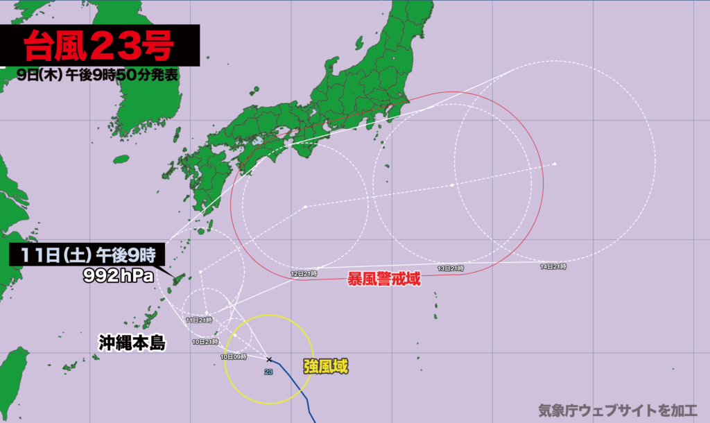
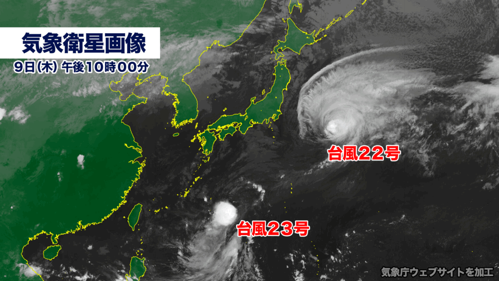
台風23号(ナクリー)は南大東島の東南東を時速約20キロで北西に進んでいます。この後はやや発達しながら北上し、11日土曜日に鹿児島県奄美大島に接近、その後、東寄りに進路を変える見込みです。
最も北寄りのルートを進んだ場合、12日日曜日から13日月曜日にかけて、暴風域を伴いながら四国や東海、関東にかなり接近する可能性があります。
また台風22号の接近で大雨、暴風、波浪に関する特別警報が出された伊豆諸島では、再び台風23号の影響を受ける恐れがあります。
9日午後9時現在、台風23号の中心気圧は1002ヘクトパスカル、中心付近の最大風速は20メートル、最大瞬間風速は30メートルです。
[Thursday, October 9, 11:00 p.m.]
Typhoon No. 23 (Nakri) is currently moving northwest at approximately 20 kilometers per hour, located to the east-southeast of Minamidaitō Island. The storm is expected to intensify slightly as it tracks northward, approaching Amami Ōshima in Kagoshima Prefecture on Saturday, October 11, before turning eastward.
If the typhoon follows the northernmost forecast path, it could come very close to Shikoku, the Tōkai region, and the Kantō region between Sunday, October 12, and Monday, October 13, bringing violent winds to wide areas.
In the Izu Islands, which have already been hit by Typhoon No. 22 and where special warnings were issued for heavy rain, strong winds, and high waves, there is concern that Typhoon No. 23 may bring renewed severe weather impacts.
As of 9:00 p.m. on the 9th, Typhoon Nakri’s central pressure was 1002 hectopascals, with maximum sustained winds near the center of 20 meters per second and gusts reaching up to 30 meters per second.
コメント