
【2025年10月19日日曜日午前11時】
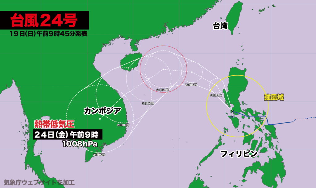
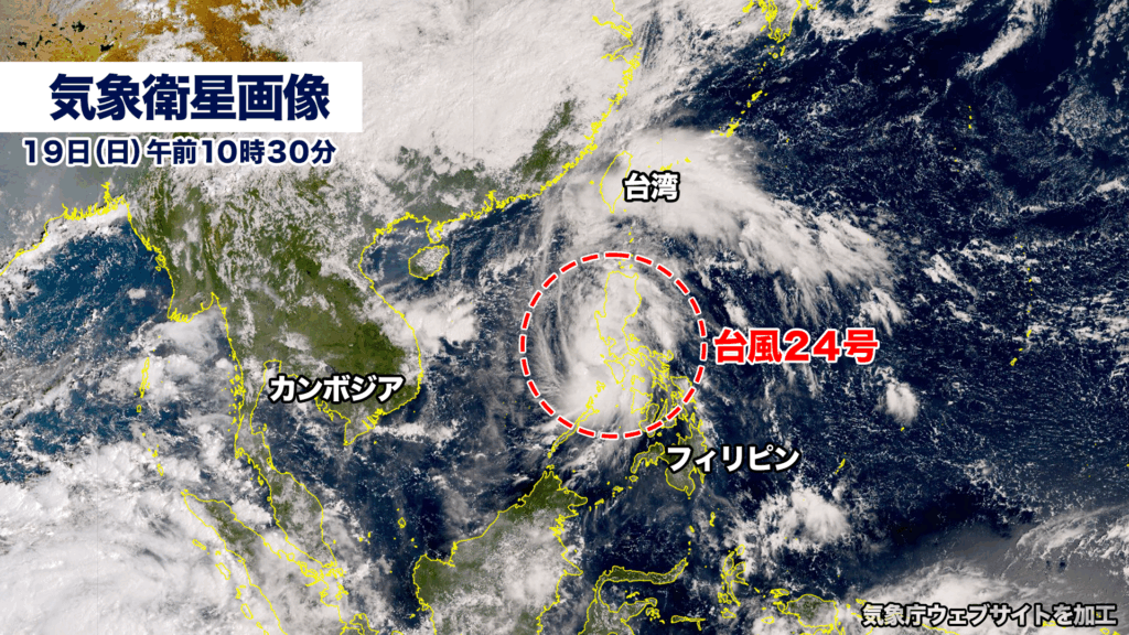
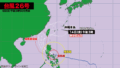
台風24号(フンシェン)がフィリピンの首都・マニラを風速15メートル以上の強風域に巻き込みながら西に進んでいます。この後はやや発達しながら南シナ海を西寄りに進み、23日木曜日にベトナムに上陸、24日金曜日にカンボジアで熱帯低気圧に変わる見込みです。
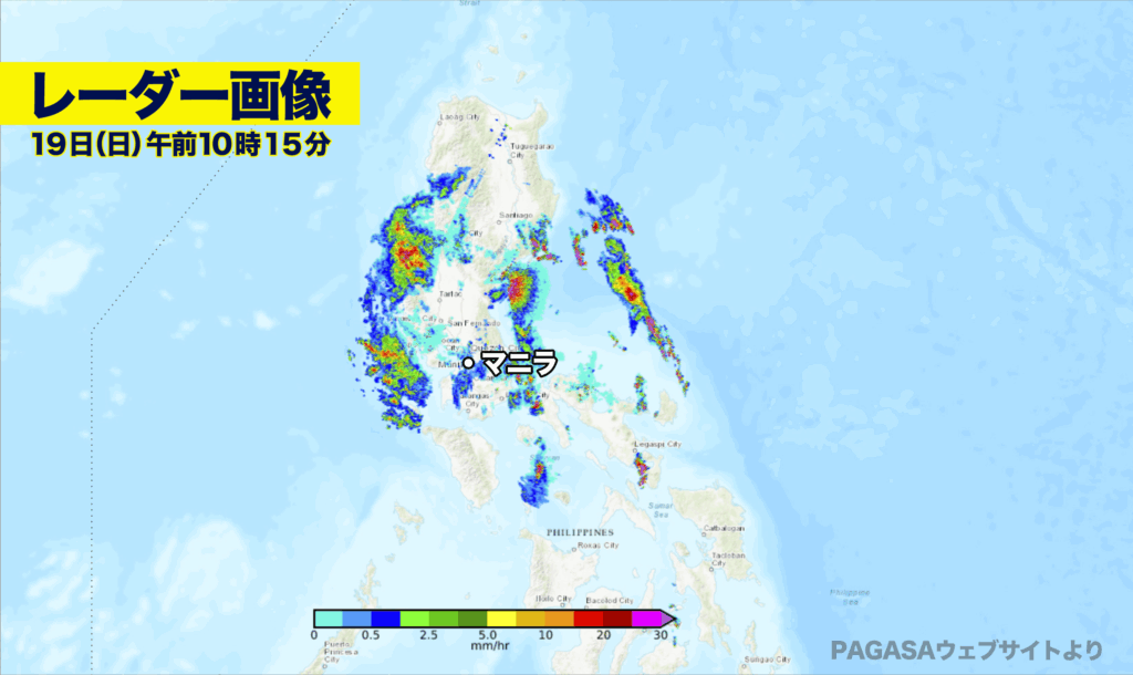
PAGASA(フィリピン大気地球物理天文局)のレーダー画像では、現在、ルソン島を中心に発達した雨雲がかかっており、一部で1時間に20ミリ以上の強い雨が降っています。台風の予想進路に入っているベトナムやカンボジアでも台風の接近に伴い、大雨による被害が発生する恐れがあります。
19日日曜日午前9時現在、台風の中心気圧は1002ヘクトパスカル、最大瞬間風速は25メートルで、時速30キロで西北西に進んでいます。
[Sunday, October 19, 2025 — 11:00 a.m.]
Typhoon No. 24 (Fung-shen) is moving westward while bringing Manila, the capital of the Philippines, into its strong wind zone with sustained winds exceeding 15 meters per second. The storm is expected to intensify slightly as it continues westward over the South China Sea, making landfall in Vietnam on Thursday, October 23, and then weakening into a tropical depression over Cambodia on Friday, October 24.
According to radar imagery from PAGASA (the Philippine Atmospheric, Geophysical and Astronomical Services Administration), developed rainbands are currently covering much of Luzon Island, with some areas experiencing heavy rainfall exceeding 20 millimeters per hour. Vietnam and Cambodia, which lie within the projected path of the typhoon, are also at risk of severe flooding and damage from heavy rains as the storm approaches.
As of 9:00 a.m. on Sunday, Typhoon Fung-shen had a central pressure of 1002 hectopascals, with maximum gusts reaching 25 meters per second, moving west-northwest at a speed of about 30 kilometers per hour.
コメント