
【9日日曜日午後6時】
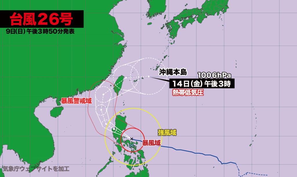
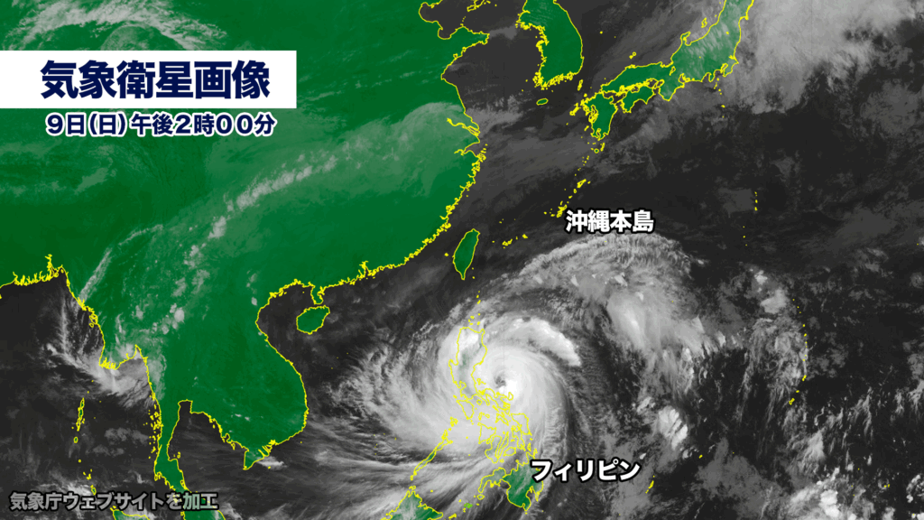
大型で非常に強い勢力の台風26号(フォンウォン)がフィリピンを通過中です。
午後3時現在、中心気圧は950ヘクトパスカル、中心付近の最大風速は45メートル、最大瞬間風速は60メートルで、勢力のピークを迎えています。
台風はフィリピンを通過後、南シナ海を北上。13日木曜日は台湾を直撃、14日金曜日に沖縄付近で熱帯低気圧に変わる見込みです。
台風の接近と通過にともない、フィリピンと台湾では大きな気象災害が発生する恐れがあります。木曜日から金曜日にかけては沖縄も大雨や強風、高波に注意が必要です。
Sunday, November 9, 6:00 p.m. (JST)
A powerful and large Typhoon No. 26, Fung-wong, is currently sweeping across the Philippines.
As of 3:00 p.m., the storm’s central pressure was measured at 950 hectopascals, with maximum sustained winds near the center reaching 45 meters per second and gusts up to 60 meters per second—marking the peak of its intensity.
After crossing the Philippines, the typhoon is forecast to move northward over the South China Sea. It is expected to make landfall in Taiwan on Thursday, the 13th, before weakening into a tropical depression near Okinawa on Friday, the 14th.
Severe weather hazards are likely in the Philippines and Taiwan as the typhoon approaches and passes through, raising the risk of significant meteorological disasters. From Thursday into Friday, Okinawa may also experience heavy rain, strong winds, and high waves, and residents are urged to remain on alert.
コメント