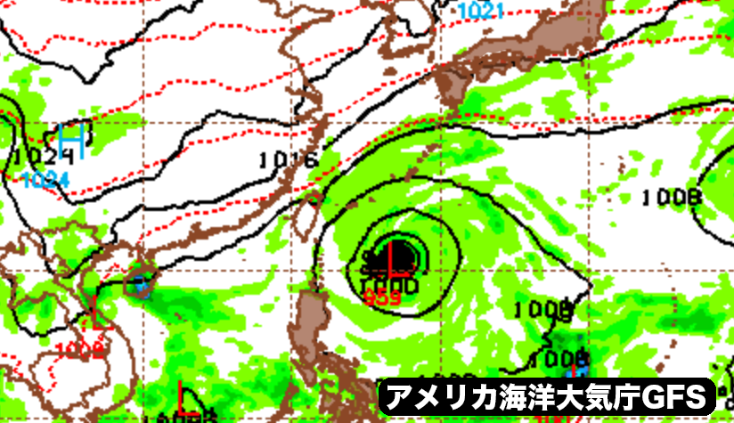
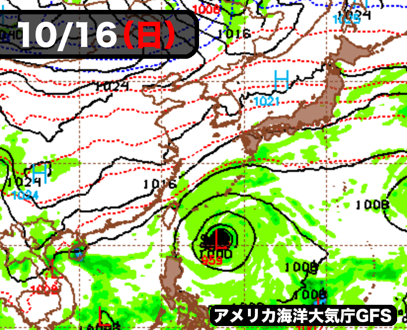
アメリカ海洋大気庁のGFSモデルによる最新予想では、約1週間後の今月16日(日曜日)に沖縄の南に熱帯低気圧が進んでくる可能性が出てきた。ヨーロッパ中期予報センターも同時期に同じような位置に低気圧を予想している。
現段階では、熱帯低気圧は北上せずに台湾とフィリピンの間のバシー海峡に向かう見込みだが、南西諸島の海上はしけ模様となり風が強まる恐れがある。
ただ、まだしばらく先の予報なので、このあと予報が変わる可能性は十分にある。
According to the latest forecasts of the National Oceanic and Atmospheric Administration’s GFS model, a tropical cyclone may move south of Okinawa on Sunday, October 16, about a week later. The European Center for Medium-Range Weather Forecasts is also predicting a low pressure system in the same location around the same time.
The tropical cyclone is not expected to move northward, but to the Bashi Channel between Taiwan and the Philippines. There is a risk of storm surge over the Nansei Islands southwest of Japan and the wind will become stronger.
It’s just a forecast for the future, so there’s a good chance that the forecast will change.
コメント