・台風2号は大型で非常に強い勢力に
・来週末は沖縄・先島諸島直撃か
・動きが遅く影響が長引く恐れ
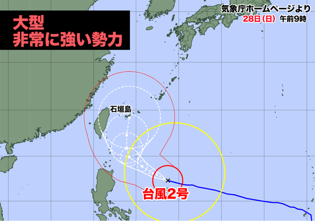

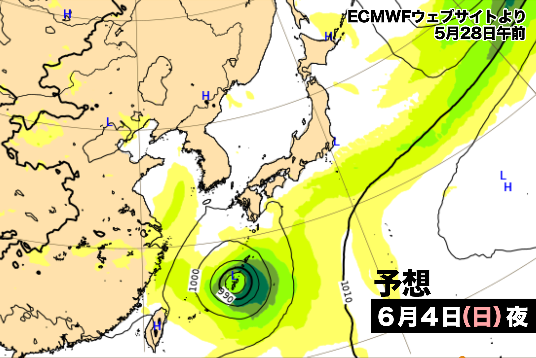
大型で非常に強い勢力の台風2号はフィリピンの東海上を西に時速20キロで進んでいる。
28日(日曜日)午前9時現在、中心気圧は935hPaで勢力のピークは過ぎたが、この後も風速25メートル以上の暴風域を伴いながら沖縄方面に向かう予想だ。
気象庁とアメリカ海洋大気局、ヨーロッパ中期予報センターの予想が段々と一致してきた。現時点での予想では来週後半に沖縄の先島諸島を直撃する恐れがある。台風の動きが遅く影響が長引く可能性があり、大雨や暴風、高波に警戒が必要だ。
Typhoon No. 2, a large and extremely powerful typhoon, is moving eastward over the sea east of the Philippines at a speed of 20 kilometers per hour.
As of 9:00 AM on Sunday the 28th, the central pressure is 935 hPa, and the peak intensity has passed. However, it is expected to continue towards the Okinawa area, accompanied by a violent wind zone with wind speeds exceeding 25 meters per second.
The forecasts from the Japan Meteorological Agency, the National Oceanic and Atmospheric Administration (NOAA), and the European Centre for Medium-Range Weather Forecasts (ECMWF) have gradually become consistent. At the current time, there is a possibility that the Sakishima Islands of Okinawa may be directly hit by the typhoon in the latter half of next week. The typhoon’s movement is slow, which may prolong the impact, so caution is necessary for heavy rain, strong winds, and high waves.

コメント