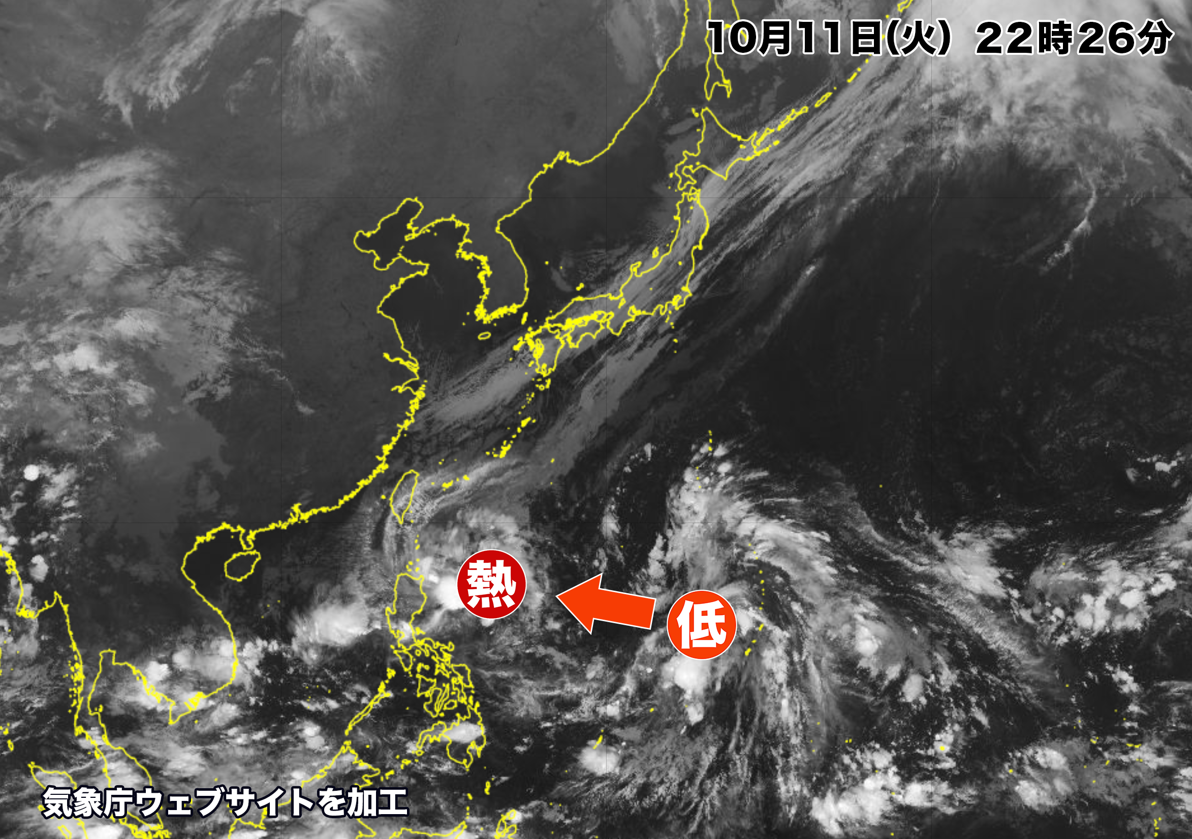

日本の南海上で次々と雲が発達している。
現在はフィリピン・ルソン島の東に熱帯低気圧があり、日本の南海上に低気圧が解析されている。
南海上の低気圧の雲はゆっくりと循環していて、まもなく熱帯低気圧になって西に進む見込み。
いずれの熱帯低気圧も台風になるかどうかはまだ不明。しかし海水温が高い海域なので可能性はある。
今のところは日本に向かって北上してくることはなさそうだが、湿った空気を日本付近に送り込むので、本州・四国・九州では秋雨前線が刺激され、16日(日)から18日(火)にかけて雨が強まる恐れがある。
Clouds are developing one after another over the sea south of Japan. Currently, there is a tropical cyclone east of Luzon Island in the Philippines, and another cyclone is being analyzed south of Japan. Storm clouds south of Japan are slowly circulating and will soon become a tropical storm and move westward. It is unclear whether each tropical cyclone will become a typhoon or not. But there is a possibility of that because of high seawater temperature. It is unlikely that they will head north toward Japan, but the latest one will send moist air into the vicinity of Japan, stimulating fronts over Honshu, Shikoku, and Kyushu, and heavy rain is expected from Sunday to Tuesday.
コメント