
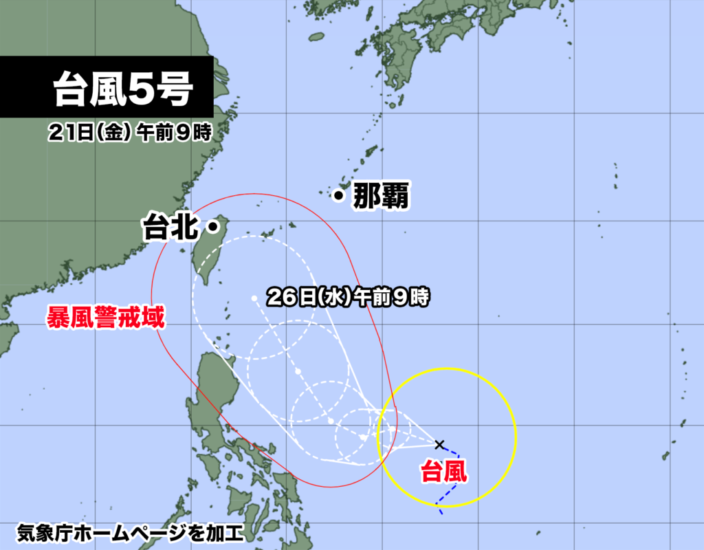
フィリピンの東にあった熱帯低気圧がきょう午前9時、台風5号になった。
中心気圧は1002hPa、中心付近の最大風速は18m/s、最大瞬間風速は25m/ s。中心の北東側440km以内と南西側330km以内では風速15m/s以上の強風が吹き、1時間に15km/hの速さで北北西に進んでいる。

海水温が高い海域を進むため発達しながら北上し、24日月曜日には強い勢力に、26日水曜日には非常に強い勢力になる見込み。予報通りに進んだ場合、26日水曜日は宮古島や石垣島など沖縄の先島諸島で風速25m/s以上の暴風が吹く恐れがある。
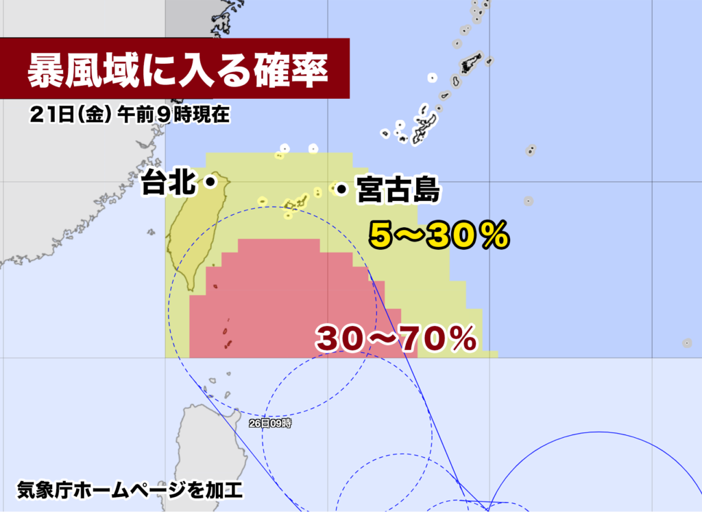
宮古島や石垣島が26日水曜日に暴風域に入る確率は、現時点で最大30%。台風の北上に伴い今後、確率はさらに上がる可能性がある。暴風や高いうねりを伴う高波、大雨による被害に備える必要がある。
At 9 a.m. today, the tropical depression located to the east of the Philippines developed into Typhoon No. 5. The central atmospheric pressure is 1002 hPa, with maximum sustained winds near the center at 18 m/s and maximum gusts reaching 25 m/s. Within 440 km to the northeast and 330 km to the southwest of the center, strong winds of 15 m/s or more are blowing, and the typhoon is moving at a speed of 15 km/h towards the north-northwest.
As it moves over areas with warm sea temperatures, it is expected to strengthen and continue its northward trajectory. By Monday, the 24th, it is anticipated to reach a strong intensity, and by Wednesday, the 26th, it may become a very powerful typhoon. If the forecast remains accurate, on Wednesday, the 26th, there is a risk of experiencing winds of 25 m/s or more on the Sakishima Islands of Okinawa, such as Miyako-jima and Ishigaki-jima.
As of now, the probability of Miyako-jima and Ishigaki-jima entering the area of destructive winds on Wednesday, the 26th, is at a maximum of 30%. However, as the typhoon continues its northward trajectory, there is a possibility that the probability may increase further. It is necessary to prepare for potential damage caused by destructive winds, high waves with significant swells, and heavy rainfall.
コメント