・フィリピンの一部が台風5号の暴風域に
・28日金曜日は中国大陸に上陸
・早くも次の熱帯低気圧が発生する可能性
・台風に発達して2日水曜日に沖縄直撃か
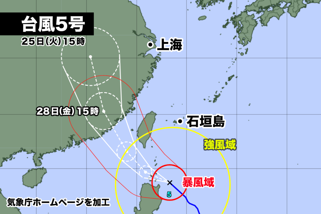
大型で非常に強い勢力の台風5号が、フィリピンのルソン島の一部を風速25m/s以上の暴風域に巻き込みながら北西に進んでいる。このあとも勢力を維持しながら北上を続け、予報円の中心を結ぶルートを進んだ場合、28日金曜日には中国福建省漳州市付近に上陸する見込み。

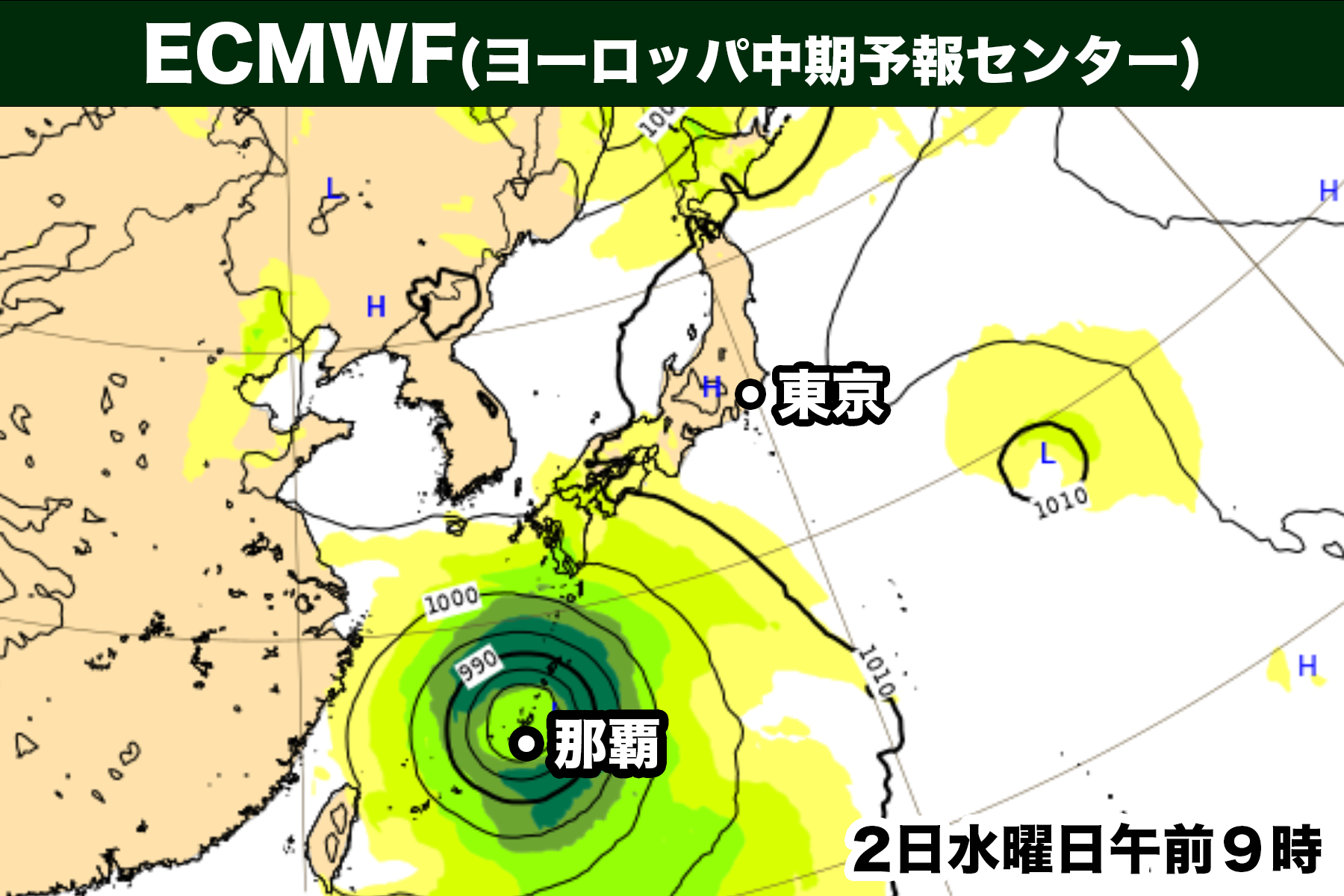
一方、次の熱帯低気圧がフィリピンの東の海上で発生し、台風に発達する可能性がある。
ヨーロッパ中期予報センターは25日火曜日現在、次の台風は8月2日水曜日に沖縄本島を直撃する予想を出している。中心気圧は980hPa以下まで下がる見込みだ。
アメリカ海洋大気局は進行スピードをそれより速く予想していて、2日水曜日には上海付近に台風が進むとみている。
いずれにしろ、来週は沖縄や奄美は次の台風の影響を大きく受ける可能性が出てきそうだ。
・工事不要。すぐに使えるおうちのWi-Fi
・BOOK☆WALKER「マンガ・雑誌読み放題」
Typhoon DOKSURI, a large and extremely powerful typhoon, is moving northwestward, engulfing parts of Luzon Island in the Philippines with winds exceeding 25 m/s in the destructive wind zone.
It is expected to maintain its intensity and continue moving northward. If it follows the track connecting the center of the forecasted circle, it is anticipated to make landfall near Zhangzhou City, Fujian Province, China, on Friday, the 28th.
On the other hand, the next tropical depression is expected to form over the eastern waters of the Philippines, with the possibility of developing into a typhoon.
As of Tuesday, the 25th, the European Centre for Medium-Range Weather Forecasts (ECMWF) has forecasted that the next typhoon will directly hit Okinawa Main Island on Wednesday, August 2nd. The central atmospheric pressure is expected to drop to below 980 hPa.
The National Oceanic and Atmospheric Administration (NOAA) in the United States, however, predicts a faster progression, indicating that the typhoon may approach Shanghai around Wednesday, the 2nd.
In any case, it appears that Okinawa and Amami are likely to be significantly affected by the next typhoon’s influence next week.
コメント