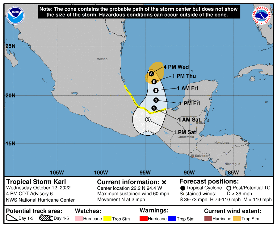
新たな熱帯低気圧がメキシコを直撃か?

10月12日(水曜日)、現地時間午後4時 (CDT)に 、熱帯低気圧カールはメキシコの東海上にあって、時速約4キロのゆっくりとしたスピードで北に進んでいる。水曜の夜はほとんど動かないが木曜の朝までに南南東へゆっくり動き始める見込み。木曜の夜は南寄りにスピードを速め、金曜の夜まで同様の動きを続ける。予想通りに進めばカールは金曜にメキシコ沿岸の注意エリア(黄色い部分)に接近する見込み。

現在、最大風速は約26メートルで、より強い突風を伴っている状況。今夜はわずかに風が強まる可能性があるが、その後、上陸までに徐々に弱まる。

強い風の範囲は中心から最大185キロ外側に広がっていて、カールから約48キロ東にあるNOAA(アメリカ海洋大気庁)の海上ブイの観測では、風速20メートル(瞬間風速23メートル)を観測。中心気圧は1002hPaと推定される。

ーーー陸地への影響
雨: 金曜日の夜までにメキシコのベラクルス州とタバスコ州の一部で7~18ミリの雨が降り、局地的には最大で最大30ミリの雨になりそう。チアパス州の一部では5ミリから10ミリ(最大15ミリ)が予想される。標高が高い所では土砂崩れによる鉄砲水が発生するおそれがある。

風: 金曜日からメキシコの海岸線に沿って熱帯低気圧クラスの強い風が吹く。

波:この先数日間はカールからのうねりがメキシコ沿岸に入り、命に関わるレベルの大波やリップカレントが発生する可能性がある。
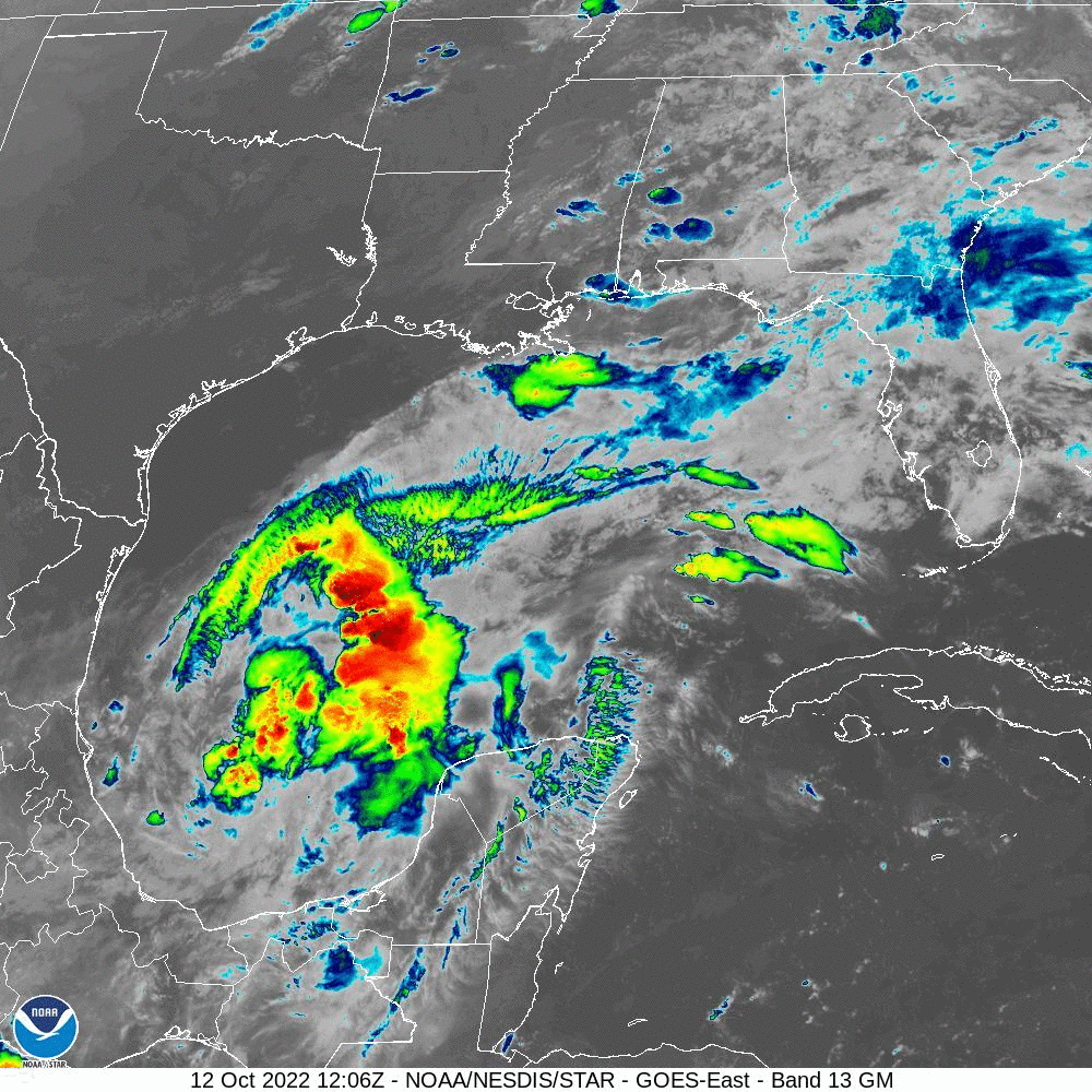
At 400 PM CDT (2100 UTC), the center of Tropical Storm Karl was located near latitude 22.2 North, longitude 94.4 West. Karl is moving toward the north near 2 mph (4 km/h). The tropical storm is forecast to move little overnight, but a slow motion to the south-southeast is expected to begin by Thursday morning. A faster generally southward motion is forecast by late Thursday, and that motion should continue through Friday night. On the forecast track, Karl will be approaching the coast of Mexico within the watch area on Friday.
Maximum sustained winds are near 60 mph (95 km/h) with higher gusts. Some slight strengthening is possible tonight, followed by gradual weakening until landfall.
Tropical-storm-force winds extend outward up to 115 miles (185 km) from the center. NOAA buoy 42055 located about 30 miles east of the center of Karl recently reported a sustained wind of 45 mph (72 km/h) with a gust to 51 mph (83 km/h).
The estimated minimum central pressure is 1002 mb (29.59 inches).
HAZARDS AFFECTING LAND
RAINFALL: Karl is expected to produce 3 to 7 inches of rain, with local maxima up to 12 inches, across portions of Veracruz and Tabasco states in Mexico through Friday night. Rainfall amounts of 2 to 4 inches, with local maxima up to 6 inches, is also expected across portions of Chiapas. Flash flooding with mudslides in higher terrain is possible.
WIND: Tropical storm conditions are possible along the Mexican coastline in the watch area starting Friday.
SURF: Swells generated by Karl are expected to affect the Mexican coastline for the next few days. These swells are likely to cause life-threatening surf and rip current conditions.
コメント