
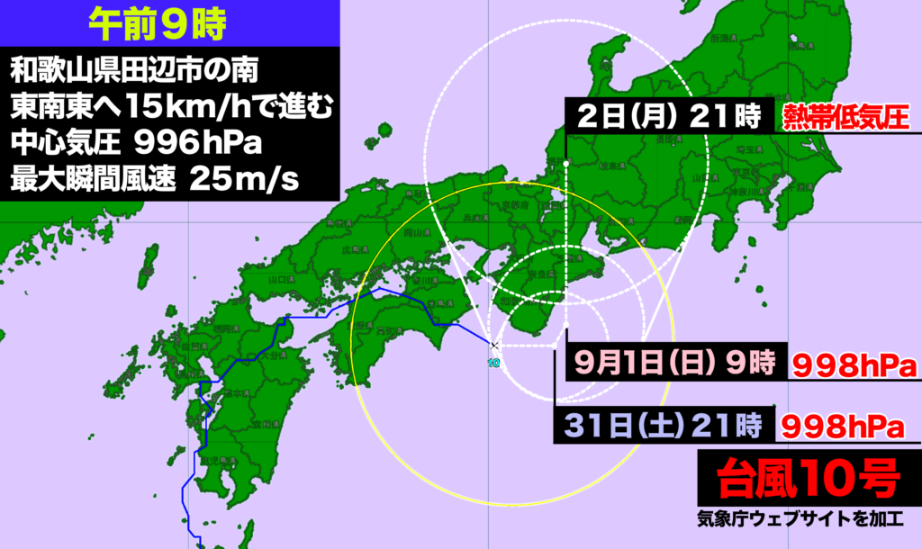
台風10号は四国を通過、31日(土)午前9時現在、和歌山県田辺市の南海上を東南東へ進んでいる。9月1日(日)は三重県の南海上で停滞し、その後、北上。2日(月)には福井県越前市で熱帯低気圧と予想されている。
上空の偏西風に流されていないため変則的な動きをしている。また進行スピードが遅く、近畿・東海地方では影響が長引きそうだ。
Typhoon No. 10 Passes Through Shikoku, Moving Southeast off the Coast of Tanabe, Wakayama Prefecture
As of 9:00 AM on Saturday, August 31, Typhoon No. 10 has passed through Shikoku and is currently moving southeast off the coast of Tanabe, Wakayama Prefecture. On Sunday, September 1, it is expected to stall over the seas south of Mie Prefecture before resuming its northward path. By Monday, September 2, it is forecast to weaken into a tropical depression over Echizen, Fukui Prefecture.
The typhoon is exhibiting irregular movement, as it is not being carried by the upper-level westerlies. Furthermore, its slow progress suggests that the Kinki and Tokai regions could experience prolonged effects.
コメント