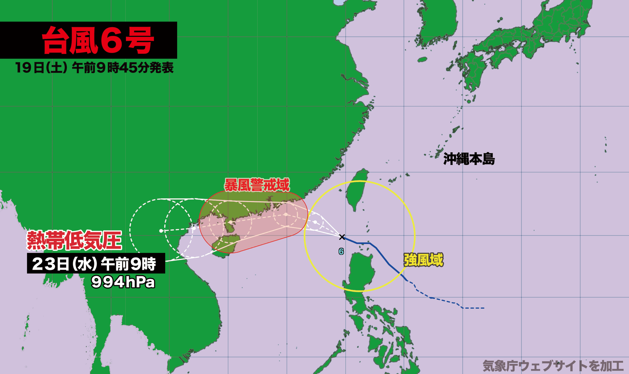

【7月19日(土) 午前9時】
18日(金)午前3時にフィリピンの東で発生した台風6号は現在、バシー海峡を抜けて南シナ海を時速約20キロで西北西に進んでいます。中心気圧は985ヘクトパスカル、最大瞬間風速は35メートル。台湾とフィリピンのルソン島が風速15メートル以上の強風域に入っています。
台風はこのあと、発達しながら西に進み、20日(日)に風速25メートル以上の暴風域が発生。勢力がピークとなり、21日(月)には中国のハイナン島にかなり接近する見込みです。
台風はその後も西寄りに進んで、23日(水)にラオスで熱帯低気圧に変わります。

[Saturday, July 19, 9:00 a.m.]
Typhoon No. 6, which formed east of the Philippines at 3:00 a.m. on Friday, July 18, is currently moving through the Bashi Channel into the South China Sea. It is traveling west-northwest at approximately 20 kilometers per hour. The central pressure is 985 hPa, and the maximum instantaneous wind speed is 35 meters per second. Areas of Taiwan and Luzon Island in the Philippines are now experiencing strong winds exceeding 15 meters per second.
The typhoon is expected to intensify as it continues westward. By Sunday, July 20, winds of 25 meters per second or more are forecast, marking the formation of a storm-force wind area. The system is projected to reach its peak strength and approach Hainan Island, China, closely on Monday, July 21.
Thereafter, the typhoon will continue westward and is expected to weaken into a tropical depression over Laos by Wednesday, July 23.

コメント