
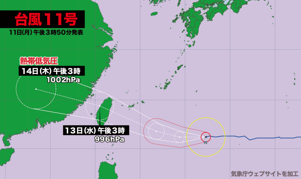
【11日月曜日午後3時】
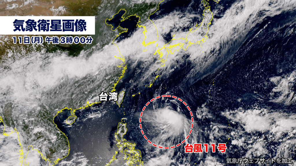
台風11号(ポードル)は風速25メートル以上の暴風域を伴い、日本の南を時速約20キロで西に進んでいます。中心気圧は985ヘクトパスカル、最大瞬間風速は45メートルです。
台風はこの後、勢力を維持しながら西に進み、13日水曜日には石垣島・西表島の南を通過、その後、台湾を直撃する可能性があります。台風の接近に際して、八重山地方では大しけ、暴風、警報級の大雨に警戒が必要です。
台風は14日木曜日には中国大陸で熱帯低気圧に変わる見込みです。
[3:00 p.m., Monday, 11th]
Typhoon Podul (Typhoon No. 11), with sustained winds of 25 meters per second or more in its storm zone, is moving westward at approximately 20 kilometers per hour south of Japan. Its central pressure stands at 985 hectopascals, and maximum instantaneous wind speeds are reaching 45 meters per second.
The typhoon is expected to maintain its strength as it tracks westward, passing south of Ishigaki and Iriomote Islands on Wednesday, the 13th. It may then go on to make a direct landfall in Taiwan. Authorities are urging residents of the Yaeyama region to prepare for heavy seas, violent winds, and rainfall at warning levels as the storm approaches.
Podul is forecast to weaken into a tropical depression over mainland China on Thursday, the 14th.
コメント