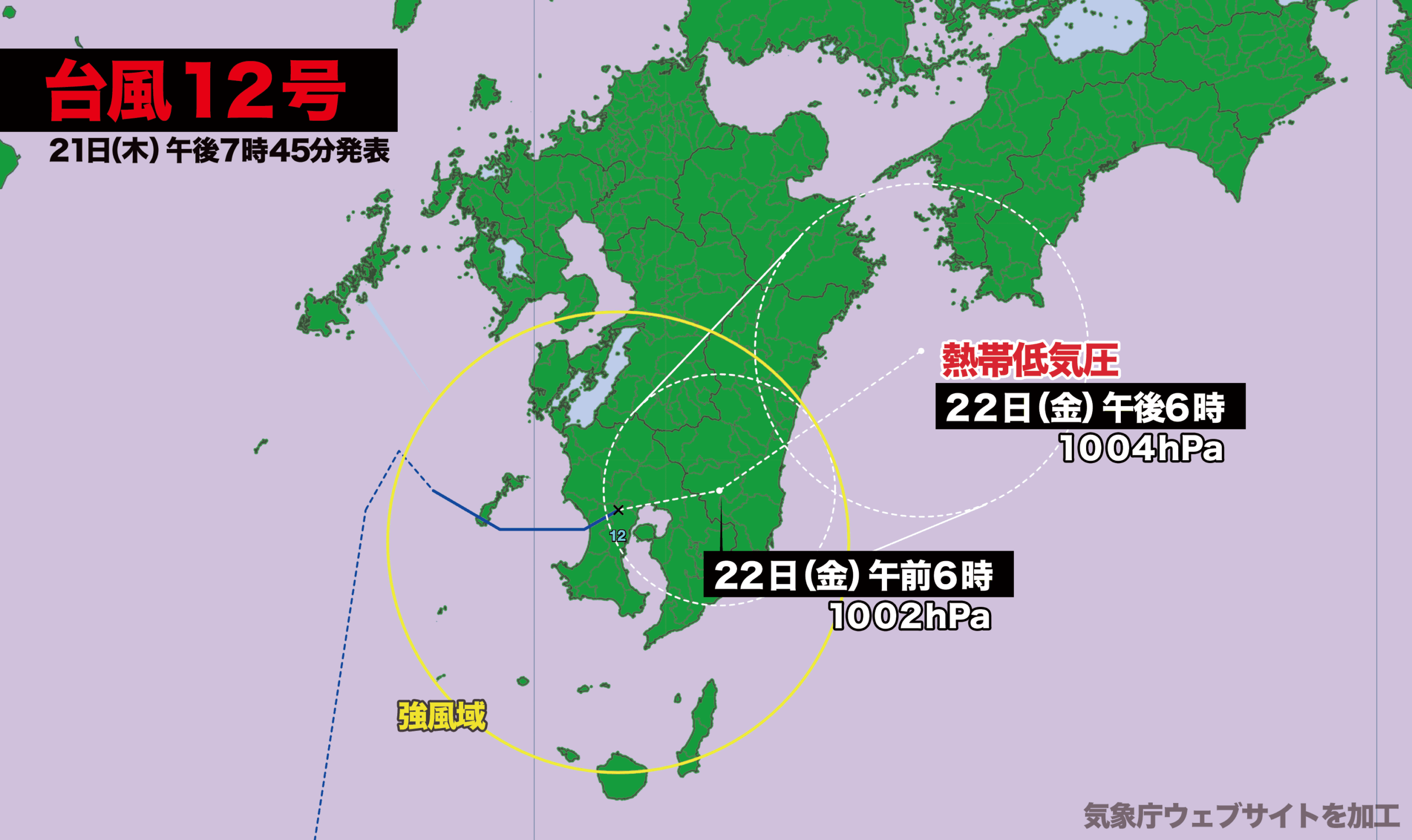
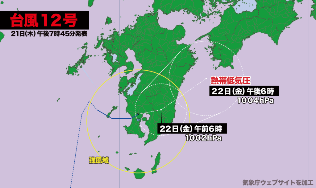
【21日木曜日午後8時】
21日午前9時、東シナ海を北上中の熱帯低気圧が台風12号(レンレン)に変わりました。
この熱帯低気圧は19日火曜日には沖縄の南にあり、鹿児島地方気象台は「台風に発達する可能性は低い」と伝えていましたが、周辺の海水温が高いことなどから予想よりも発達しました。
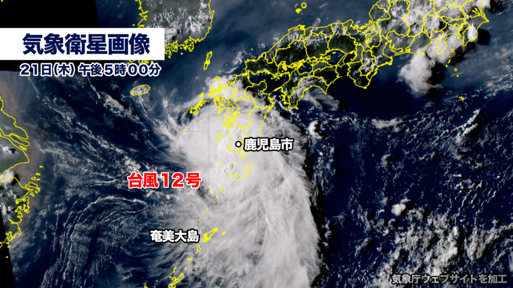
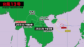
午後5時過ぎには鹿児島県日置市付近に上陸、午後7時現在、中心は鹿児島市付近にあり、ゆっくりとした速さで東北東に進んでいます。中心気圧は1002ヘクトパスカル、中心付近の最大風速は20メートル、最大瞬間風速は30メートルです。
21日は台風と取り巻く雨雲が鹿児島県にかかり、いちき串木野市では1時間に約120ミリの雨が降り記録的短時間大雨情報が出るなど、各地で土砂災害の危険度が高まっています。
台風はこのあと停滞し、その後ゆっくりと東に進み、22日午前6時に宮崎県都城市付近、22日午後6時には高知県宿毛市の南西に達して熱帯低気圧に変わる見込みです。
[Thursday, 21st — 8:00 p.m.]
At 9 a.m. on the 21st, a tropical depression moving north over the East China Sea strengthened into Typhoon No. 12 (Lanlan).
The system had been located south of Okinawa on Tuesday the 19th, and the Kagoshima Meteorological Observatory had stated that “the likelihood of development into a typhoon is low.” However, due to higher-than-expected sea surface temperatures in the surrounding waters, the storm intensified beyond forecasts.
Shortly after 5 p.m., the typhoon made landfall near Hioki City, Kagoshima Prefecture. As of 7 p.m., its center was located near Kagoshima City, moving slowly to the east-northeast. The central pressure was 1002 hPa, with maximum sustained winds of 20 meters per second and gusts up to 30 meters per second.
Throughout the 21st, Kagoshima Prefecture came under the influence of the typhoon and its associated rainbands. In Ichikikushikino City, torrential downpours brought approximately 120 millimeters of rain in one hour, prompting authorities to issue an emergency warning for record-short-duration rainfall. Landslide risk levels have risen significantly across the region.
The typhoon is expected to stall before gradually moving eastward. Forecasts indicate it will reach near Miyakonojo, Miyazaki Prefecture at 6 a.m. on the 22nd, and by 6 p.m. the same day, it is projected to be southwest of Sukumo, Kochi Prefecture, where it is likely to weaken into a tropical depression.
コメント