
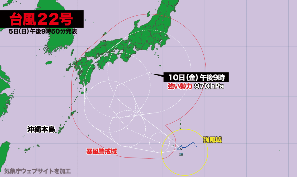
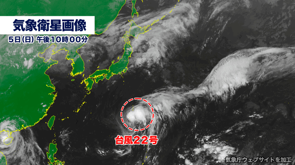
【5日日曜日午後10時】
台風22号(ハーロン)は現在、小笠原諸島でほとんど停滞しています。この後は発達しながら西寄りに進み、少しずつ進路を北に変更、9日木曜日には東寄りに進む見通しです。予報円の中心を進んだ場合、10日金曜日に強い勢力で東海・関東の南に達する予想です。
台風22号は動きの予想が難しく、中心が70%の確率で入る予報円がかなり大きいのが特徴です。台風が最も北寄りのルートを進んだ場合、西日本から東日本に上陸する可能性があり、各地が風速25メートル以上の暴風域に巻き込まれる恐れがあります。
[10:00 p.m., Sunday, October 5]
Typhoon No. 22, named Halon, is currently nearly stationary over the Ogasawara Islands. The storm is expected to intensify while moving westward, gradually curving to the north, and then shifting eastward around Thursday, October 9. If it continues along the center of the forecast track, the typhoon is projected to approach the area south of the Tokai and Kanto regions with strong intensity by Friday, October 10.
Forecasting the typhoon’s movement remains challenging, as indicated by the unusually large forecast circle showing the area where the center has a 70 percent probability of being located. Should the typhoon take the northernmost route, it could make landfall somewhere between western and eastern Japan, bringing the risk of violent winds exceeding 25 meters per second across a wide area.
コメント