

◾️9月3日(火)午後9時
ヨーロッパ中期予報センター(ECMWF)の最新の予想では、来週木曜日あたりに熱帯低気圧が九州を直撃する可能性が示されている。現時点では、予報が更新されるごとに熱帯低気圧の位置は変化しているが、来週は九州・沖縄方面で何らかの影響が出るかもしれない。
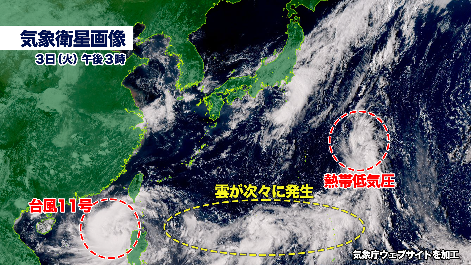
気象衛生画像を見ると、太平洋には次々と積乱雲が発生しているエリアがある。しばらくは熱帯低気圧や台風の生まれやすい状態がつづきそうだ。
現在、日本の南にある熱帯低気圧は、北上が予想されるが急速に発達する兆候はない。
According to the latest forecast from the European Centre for Medium-Range Weather Forecasts (ECMWF), there is a possibility that a tropical cyclone could directly impact Kyushu around next Thursday. Although the projected path of the tropical cyclone has been shifting with each forecast update, it is likely that the Kyushu and Okinawa regions may experience some effects next week.
Satellite imagery reveals an area in the Pacific where cumulonimbus clouds are continuously forming, indicating that conditions conducive to the development of tropical cyclones and typhoons may persist for some time.
Currently, the tropical cyclone located south of Japan is expected to move northward, though there are no signs of rapid intensification at this moment.

コメント