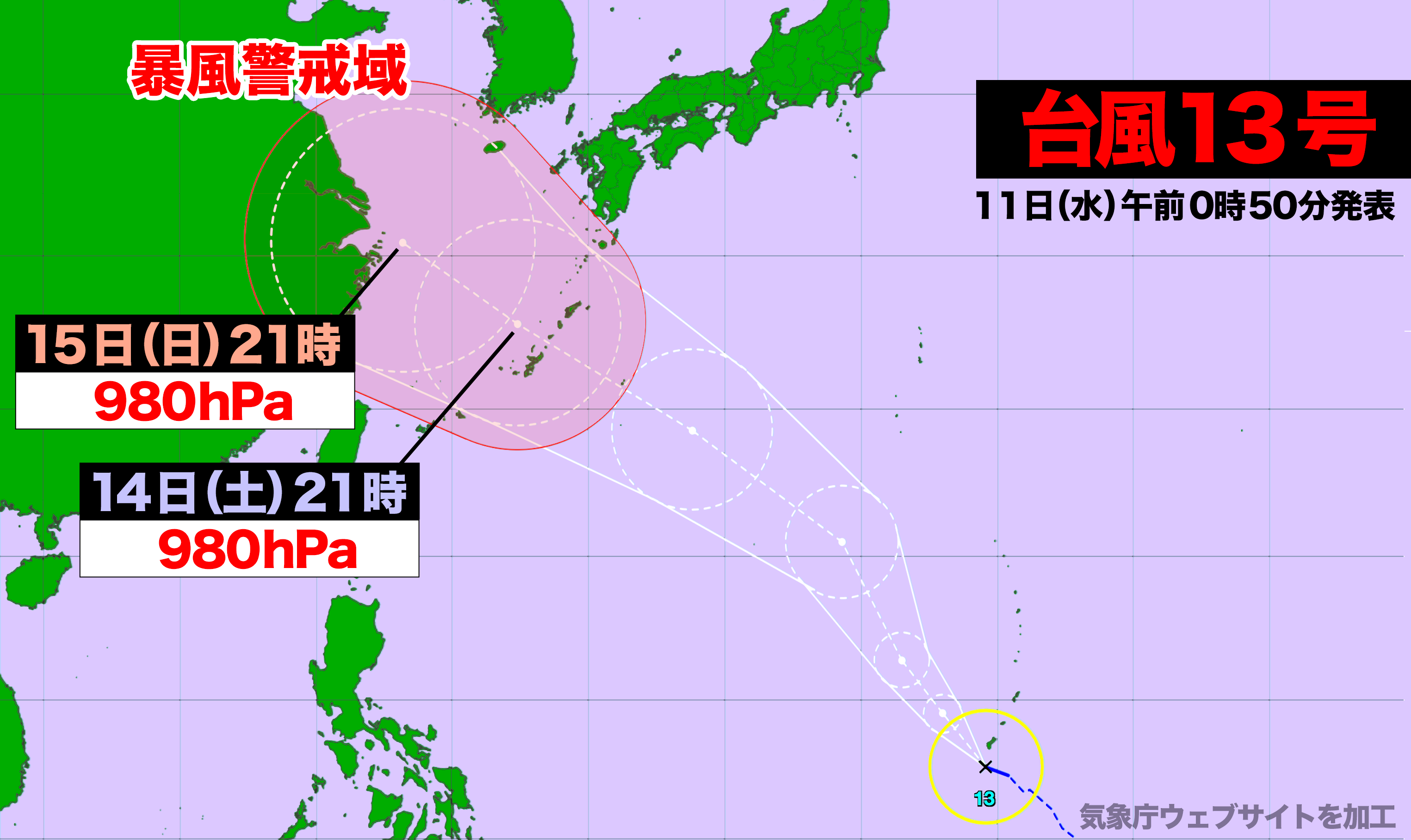

10日(火)午後9時、マリアナ諸島にあった熱帯低気圧が台風13号になった。
今後はしだいに発達しながら北西に進み、予報円の中心を進んだ場合、14日(土)の夜に暴風域を伴い沖縄本島地方や奄美地方南部に最も接近する見込み。
中心気圧は980hPaと予想されるが、周辺海域の海水温が高く、予想よりも気圧が低くなり発達する可能性がある。
この台風の影響で3連休初日は南西諸島は雨風ともに強まり、海上はおおしけとなりそうだ。
At 9 p.m. on Tuesday, the tropical depression near the Mariana Islands intensified into Typhoon No. 13. It is expected to gradually strengthen as it moves northwest. Should the storm follow the projected path, it is anticipated to approach the southern Amami region and Okinawa’s main island by Saturday night, bringing strong winds.
The central pressure of the typhoon is forecast to be 980 hPa, but due to the high sea surface temperatures in the surrounding waters, it could intensify beyond predictions. As a result, the first day of the upcoming three-day weekend may see strong winds and heavy rain in the southwestern islands, with rough sea conditions likely.
コメント