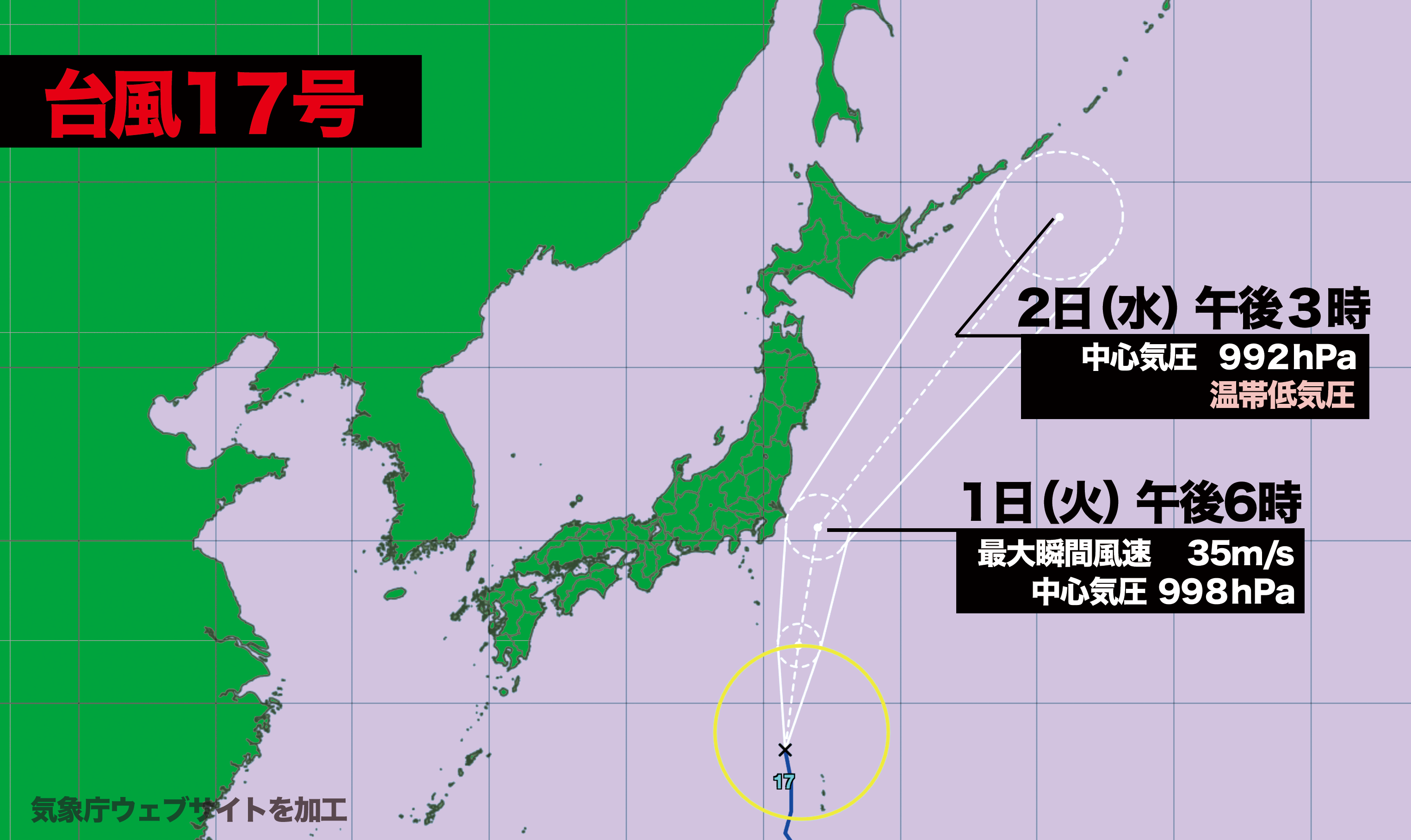

台風17号は30日(月)午後6時現在、父島の北西約210キロの海上にあって、1時間に30キロのスピードで北に進んでいる。この後、やや発達しながら北に進む予想で、予報円の中心を進んだ場合、1日(火)の午後6時には千葉県の東海上に達し、関東地方に最も接近する見込み。
夕方の時間帯での最接近となるため、学校や会社から帰宅する際は雨風が強まる恐れがある。
台風は2日(水)の午後3時に、北海道の東海上で温帯低気圧に変わる。
As of 6:00 p.m. on Monday, Typhoon No. 17 was located approximately 210 kilometers northwest of Chichijima, moving northward at a speed of 30 kilometers per hour. The storm is expected to continue moving north while intensifying slightly. If it follows the projected course, it is forecast to reach the waters east of Chiba Prefecture by 6:00 p.m. on Tuesday, coming closest to the Kanto region.
As this will coincide with the evening commute, there is a risk of worsening rain and wind conditions for those returning from school or work. By 3:00 p.m. on Wednesday, the typhoon is expected to weaken into an extratropical cyclone over the waters east of Hokkaido.

コメント